The Law of the Sea and South Korea: The Challenges of Maritime Boundary Delimitation in the Yellow Sea
The objective of this analysis is to explore these issues that have served to forestall significant progress in maritime boundary delimitation negotiations between China and South Korea with respect to their overlapping maritime entitlements in the Yellow Sea. The essay considers alternative options and potential pathways whereby the two states might reconcile, overcome, or sidestep their conflicting approaches, and manage their overlapping claims and shared maritime spaces.
The Yellow Sea, known as the West Sea to Korea, is a semi-enclosed sea area, located between the mainland of China and the Korean Peninsula, which constitutes the northern extent of the East China Sea. It has an area of approximately 400,000 square kilometers and is consistently less than 400 nautical miles (nm) wide. Delimitation of overlapping continental shelf and exclusive economic zone (EEZ) entitlements is thus necessary. In particular, maritime delimitation in the Yellow Sea is seen as important with respect to the management of the region’s substantial fisheries resources. Indeed, despite cooperative efforts, illegal fishing incidents have proliferated and remain an ongoing source of friction in relations between China and the Republic of Korea (ROK, also referred to here as South Korea).[1]
The evident lack of progress achieved in past bilateral efforts toward the delimitation of a maritime boundary between China and South Korea can be attributed to multiple factors. First, and perhaps most significantly, the critical ingredient to any successful boundary negotiation, that is, political will on both sides, appears to be uncertain. It seems that neither government has regarded the issue as one in urgent need of resolution, meaning that the requisite political impetus to make the compromises necessary to achieve a maritime boundary agreement has been lacking. Second, the two sides adopted radically different and opposing views as the basis for their respective maritime entitlements in the Yellow Sea, which in turn led to fundamentally incompatible approaches to maritime boundary delimitation. Third, both states have claimed questionable baselines along their coasts. Additionally, a submerged rock known as Suyan Jiao in Chinese, Ieodo in Korean, or Socotra Rock in English represents a subsidiary but potentially complicating issue.
Taken together, these issues have served to forestall significant progress in maritime boundary delimitation negotiations between China and South Korea with respect to their overlapping maritime entitlements in the Yellow Sea. The objective of this analysis is to explore these issues with a view to assessing what has changed and what potential options exist that may result in renewed negotiations bearing fruit. The essay then considers alternative options and potential pathways whereby the two states might reconcile, overcome, or sidestep their conflicting approaches, and manage their overlapping claims and shared maritime spaces.
Regional Context: Existing Management Mechanisms in the East China Sea
Despite significant challenges, littoral states in the East China Sea have taken a number of positive steps toward the management of their overlapping claims to maritime jurisdiction. Three joint fisheries agreements—which emerged following the ratification of the United Nations Convention on the Law of the Sea (UNCLOS); the declaration of EEZs by China, Japan, and the ROK; and the resulting overlapping maritime claims—may be considered together. The fisheries agreements in question are: the agreement between China and Japan on November 11, 1997, relating to part of the East China Sea; the agreement between Japan and South Korea in January 2000 with respect to parts of both the East China Sea and the Sea of Japan (known as the East Sea in South Korea); and the agreement between China and South Korea on June 30, 2001, dealing with parts of the Yellow Sea.[2]
These joint agreements are of a provisional nature and are without prejudice to final maritime boundary delimitation. They have drawbacks, however. Notably, they provide for enforcement on a flag state basis with minimal joint enforcement envisaged and include no provisions for enforcement against third parties (such as Taiwan, which is a significant fishing entity in the East China Sea). Furthermore, the joint agreements encompass only part of the area within overlapping claims where fishing is taking place, and they do so in an uncoordinated and unregulated fashion. Nonetheless, the joint zones established, which are aimed at facilitating the coordinated management of fishing activity within them, even if they are exclusively bilateral in character, represent positive steps toward finding cooperative solutions to shared problems and a potentially useful application of maritime joint development concepts to shared living resources.
Delimitation Considerations in the Yellow Sea
The representatives of China and South Korea held meetings at the director-general level fourteen times between 1996 and 2008. They then resumed negotiations on maritime delimitation from 2015 onward, with two meetings at the vice-minister level and six meetings at the director-general level. Reflecting the lack of progress in their earlier talks, the two sides agreed to refer to their first vice-ministerial negotiations on December 22, 2015, as their first formal meeting on the issue of maritime delimitation. Following these discussions, the ROK Ministry of Foreign Affairs outlined its “basic position” through a press release that “both parties agreed to proceed with negotiations in the spirit of cooperation, reciprocity, and mutual trust, in order to achieve an equitable solution in the overlapping areas on the basis of international law including the 1982 Law of the Sea Convention.”[3]
Despite the multiple rounds of talks noted above, it appears that no breakthrough has been achieved. What, then, are the key challenges that need to be overcome for future negotiations to be successful where past efforts have failed? This section reviews the main considerations that will need to be addressed in order for a China-ROK maritime boundary to be delimited in the Yellow Sea.
Political will. The political will to meaningfully address a maritime boundary delimitation dispute is crucial. This critical factor was arguably undermined in the past due to fisheries disputes, one of the core practical maritime issues and a source of ongoing friction between the two states. This issue was perceived to have been managed through the 2001 Korea-China Fisheries Agreement, which ostensibly addresses the primary ongoing source of day-to-day disputes between the parties in the area of overlapping maritime claims and arguably reduces the political impetus toward delimiting a China-ROK maritime boundary in the Yellow Sea. However, it has become apparent over time that this joint fishing agreement has not led to rational management of fisheries and a reduction in the number of fishery-related incidents between the parties.
An important contributing factor to consider is the significant overcapacity in China’s fishing fleet, which has led to the depletion of stocks in waters proximate to China. This factor, marine pollution in Chinese waters, and the seemingly ever-growing demand for seafood in China have acted as powerful drivers for Chinese fishing activity farther from the country’s shores.[4] In the absence of effective measures on the part of the Chinese authorities to restrain, control, or regulate behavior or address overcapacity issues, the consequence has been that the Chinese fishing fleet increasingly operates in the eastern (that is, undisputedly Korean) part of the Yellow Sea. As a result, fisheries-related incidents involving Chinese fishing vessels and ROK maritime enforcement authorities have proliferated. For example, in 2018 the Korea Coast Guard apprehended 136 Chinese fishing vessels, and the ROK government imposed bonds on these vessels of about 12.6 billion won (approximately $10 million).[5] This situation of ongoing, frequently violent, fisheries incidents has in turn enhanced the political desire for a definitive delimitation of a maritime boundary and thus helped restart maritime boundary negotiations.
The political will of the parties is therefore at least partially related to marine resource concerns, which provide a push-and-pull dynamic. Even as ongoing fishery disputes promote moves toward maritime delimitation, they can simultaneously make it harder to achieve compromise as a consequence of efforts by coastal states to protect access to fish stocks in “their” waters. Speculative estimates about seabed energy resources also provide an impetus toward the delimitation of a maritime boundary in the Yellow Sea, while at the same time being a potentially significant impediment.[6]
There is a desire on the South Korean side to resolve maritime boundary issues in the Yellow Sea. This is not only because current arrangements are clearly not working but also because it would be desirable to delimit the maritime boundary as soon as possible. Delimitation would clarify jurisdictional rights and thus help prevent potential conflicts by delimiting a boundary line. It must be presumed that the Chinese side also desires resolution of its dispute with the ROK. This would have the merit of demonstrating China’s willingness to reach negotiated solutions in a neighborly fashion, thus restoring confidence in China as a negotiating partner in other maritime disputes. However, it is difficult to assess with certainty the level of willingness of either side to make the compromises essential to reaching an agreement between their contending positions.
Applicable law on baseline and maritime claims. Both China and South Korea are parties to UNCLOS.[7] For these states, therefore, UNCLOS provides the binding legal framework governing maritime jurisdictional claims and the delimitation of maritime boundaries between national maritime zones. Indeed, those parts dealing with maritime claims and maritime boundary delimitation can be considered declaratory of customary international law. In accordance with UNCLOS, both China and South Korea claim a 12 nm territorial sea, a contiguous zone to 24 nm, and an EEZ to a maximum breadth of 200 nm from baselines.[8] As noted above, since the Yellow Sea is less than 400 nm across, the two countries have overlapping continental shelf and EEZ claims.
Both South Korea and China have defined systems of straight baselines along significant parts of their Yellow Sea coastlines. Straight baselines are dealt with in Article 7 of UNCLOS. The critical first paragraph indicates the geographic conditions of coastlines where baselines are permitted as follows: “where the coastline is deeply indented and cut into, or if there is a fringe of islands along the coast in its immediate vicinity.” The article does not establish objective tests, however, and as a result has been open to varied, and often excessive, interpretation and application. Both China’s and South Korea’s straight baseline claims have been subject to adverse attention internationally, notably from the United States.[9] However, they are not equivalently excessive. China’s straight baseline claim links small and in some cases submerged features, which are widely separated from one another as well as being located at a significant distance offshore. In marked contrast, South Korea’s mainland coast is fronted by a profusion of islands, the outermost of which provide the basepoints for its system of straight baselines. The key point here is that South Korea’s islands themselves generate maritime claims.
Were maritime delimitation to be placed in the hands of an international court or tribunal, it is highly likely that straight baseline claims would be discounted and the starting point for delimitation would be an equidistance line calculated between normal baselines. After all, the International Court of Justice (ICJ) has consistently ignored claimed straight baselines and stated unequivocally in 2001 that straight baselines are “an exception to the normal rules for the determination of baselines” and “must be applied restrictively.”[10] This would be more advantageous to South Korea than China, given the disparity between their baseline systems. That is, China’s straight baselines are generally located farther from the actual location of the coast than are South Korea’s. International jurisprudence would also appear to strengthen the ROK’s position in favor of a strict equidistance line based on normal baselines coincident with low-water lines along the coast.
Since the ruling in the Black Sea case between Ukraine and Romania in 2009, international courts and tribunals have consistently applied a “three stage” process or approach to maritime delimitation.[11] This involves, “in keeping with its settled jurisprudence on maritime delimitation,” the construction of a provisional line based on equidistance “unless there are compelling reasons that make this unfeasible in the particular case” (emphasis added) at the first stage, consideration of factors calling for the adjustment of the provisional line at the second stage, and a checking procedure for disproportionality at the third stage.[12] Subsequent cases have adhered to this three-stage approach, albeit without defining a strict equidistance line at the first stage of the process. In keeping with the Black Sea case, international judicial bodies have opted to construct equidistance lines from “the most appropriate points on the coasts of the two States concerned, with particular attention being paid to those protuberant coastal points situated nearest to the area to [be] delimited.”[13]
In the case of a potential maritime delimitation between South Korea and China, only the relevant coastline would be considered for delimitation. If the area for negotiation does not deviate considerably from the Provisional Measure Zone of the Fisheries Agreement between Korea and China, and given that the ratio of the lengths of the relevant coastlines of China and Korea is about 1 to 0.8 (820 and 660 kilometers, respectively),[14] it is unlikely that this will require an adjustment to the provisional line under the disproportionality test. That said, this consideration only becomes relevant if equidistance is applied as the basis for delimitation, which is not certain given the contending positions of the parties.
Conflicting approaches to maritime entitlements and boundary delimitation. The primary cause of the broad area of overlap between the parties’ claims in the Yellow Sea is their radically different views on the method of maritime delimitation to be applied rather than the questionable nature of their claims to straight baselines. Neither China nor South Korea has been explicit regarding its claims in the Yellow Sea. That is, neither state has clearly articulated the basis for its maritime claims nor defined a unilateral claim line in the Yellow Sea. Nonetheless, their domestic laws provide an indication of the positions likely to be adopted by the two states.
China’s EEZ and Continental Shelf Act provides that where conflicting claims exist between China and states with opposite or adjacent coasts, these shall be settled “on the basis of international law and in accordance with the principle of equity, by an agreement delimiting the areas so claimed.”[15] By contrast, South Korea’s EEZ and Continental Shelf Act merely indicates that the delimitation of the EEZ with opposite or adjacent states shall be effected “by agreement with the states concerned on the basis of international law.”[16] However, the act also stipulates that South Korea’s EEZ rights “shall not be exercised in the area of the sea beyond the median line between the Republic of Korea” and neighboring states “unless otherwise agreed upon with the state concerned.” The median line is defined as “the line every point of which is equidistant from the nearest point on the baseline of the Republic of Korea and the nearest point on the baseline of the State concerned.”[17]
Although China and South Korea have not been entirely explicit in their maritime boundary claims, their contrasting views are apparent. The Korean position is that the equidistance or median line between opposing coasts should be the basis for maritime delimitation. In contrast, the emphasis on “equity” in China’s EEZ and continental shelf legislation is in keeping with suggestions that factors such as the comparative length of relevant coastlines and natural prolongation-inspired “silt line” arguments should be considered.
This position is inspired by the ICJ ruling in the North Sea Continental Shelf cases that coastal states have rights over that part of the continental shelf that constitutes a “natural prolongation of its land territory into and under the sea.”[18] Accordingly, coastal states have advanced arguments on geological and geomorphological grounds to demonstrate continuity between land and continental shelf areas. The Chinese silt line argument essentially suggests that the sediments that make up the seabed and subsoil underlying the Yellow Sea are derived more from the Chinese than the Korean side, and so the maritime boundary should be shifted farther east to China’s advantage. That said, the ICJ subsequently did away with such geophysical arguments, at least in relation to those areas within 200 nm of the coast. In the Libya-Malta case in 1985, on the basis of “new developments in international law”—that is, the opening of UNCLOS for signature in 1982 and the introduction of the EEZ concept—as there was less than 400 nm between the parties’ coastlines, “the geological and geomorphological characteristics of those areas…are completely immaterial.”[19] Consequently, South Korea is likely to reject China’s arguments along these lines.
It is worth noting that South Korea’s preference for using the equidistance line as a basis for the delimitation of a maritime boundary with China in the East China Sea is at odds with its arguments in favor of using natural prolongation as a basis for the delimitation of a maritime boundary with Japan. China’s arguments in favor of geophysically based maritime boundaries vis-à-vis both South Korea and Japan thus at least have the virtue of consistency, as China applies the same argument with respect to Japan. While every maritime boundary scenario is unique, this apparent inconsistency may leave South Korea open to a challenge by China in their bilateral discussions.
Alternative Options
In the face of deadlocked negotiations between China and South Korea, a number of alternative options may be considered for clarifying a maritime boundary line in the Yellow Sea. One option that may accelerate the delimitation process is to approach it piece by piece. That is, the two countries could engage in delimitation efforts on the more straightforward parts of the overall delimitation line and establish a comprehensive maritime boundary one stage at a time. An example of this approach is provided by the territorial sea negotiations between Indonesia and Singapore, which yielded three agreements relating to three separate but adjoining parts of their territorial sea boundary.[20]
The merit of delimiting an area that is more limited in scope is that this would avoid the complications of dealing with areas where third states have asserted claims—specifically, North Korea and Japan. In the north, China and South Korea are likely to need to narrow the area for negotiation by excluding the area around the Northern Limit Line and South Korea’s five northern islands, which are close to North Korea’s coastline. Similarly, in the south, they may need to avoid the area in the East China Sea in which the jurisdictions of South Korea, China, and Japan overlap. Other options include separate water column and seabed boundaries, which exist between Australia and Indonesia in the Timor Sea and Australia and Papua New Guinea in the Torres Strait. Fundamental issues of contrasting approaches and bases of entitlement still need to be overcome, however. Furthermore, extensive, and ideally more robust, joint zone arrangements remain an alternative cooperative route to pursue in the face of apparently irreconcilable positions.
That negotiations between China and South Korea concerning maritime boundary delimitation have been revived, or arguably started in earnest for the first time in 2015, is undoubtedly positive. However, it appears that the long-standing and conflicting positions of the two sides remain unchanged. The lack of evident progress in negotiations suggests that it is uncertain whether enough political will, albeit a difficult factor for external observers to gauge accurately, exists to reach a compromise outcome between contending positions. The option of bifurcating or separating seabed and water column boundaries may provide a creative and attractive outcome potentially yielding a continental shelf boundary somewhat nearer the Korean than the Chinese side of the Yellow Sea, with a water column boundary more consistent with the equidistance line between opposing coasts. This would deliver a continental shelf boundary consistent with both China’s and South Korea’s positions vis-à-vis Japan farther south in the East China Sea and a clear separation of jurisdictional rights over fisheries, which could possibly, though not inevitably based on recent practice in the area, assist in resolving fisheries-related conflicts. It is important to note, however, that even once maritime boundaries are finally delimited, transboundary cooperation will still be essential, not least for the preservation of the environment of a shared semi-enclosed sea area and for the management of pooled marine resources as well as for the sake of good ocean governance and order at sea.
Seokwoo Lee is a Professor at Inha University Law School in South Korea.
Clive Schofield is the Head of Research in the WMU-Sasakawa Global Ocean Institute at the World Maritime University in Sweden.
Download a PDF version of this analysis piece here.
ENDNOTES
[1] See Seokwoo Lee and Young Kil Park, “The Legal Assessment of the Illegal Fishing Activities of Chinese Fishing Vessels: A Focus on Detention of Foreign Vessels,” Korean Journal of International and Comparative Law 1, no. 1 (2013): 31–48.
[2] See Sun Pyo Kim, “The UN Convention on the Law of the Sea and New Fisheries Agreements in North East Asia,” Marine Policy 27, no. 2 (2003): 97–109; and Seokwoo Lee, Young Kil Park, and Hansan Park, “The Complex Legal Status of the Current Fishing Pattern Zone in the East China Sea,” Marine Policy 81 (2017): 219–28.
[3] Ministry of Foreign Affairs (ROK), Press Release, December 22, 2015.
[4] See Suk Kyoon Kim, “Illegal Chinese Fishing in the Yellow Sea: A Korean Officer’s Perspective,” Journal of East Asia and International Law 2 (2012): 473.
[5] Korea Coast Guard, 2019 Korea Coast Guard Annual Report (Seoul, 2019), 380.
[6] Hee-Cheol Yang, “Research on the Factors to Consider in the Yellow Sea Maritime Boundary Delimitation between Korea-China and Countermeasures to It,” Korean Journal of International Law 57, no. 3 (2012): 111 (in Korean).
[7] China signed UNCLOS on December 10, 1982, and became a party to it on June 7, 1996. South Korea signed UNCLOS on March 14, 1983, and became a party to it on January 29, 1996. The proximate concerned states with which tripoints on a China-Korea maritime boundary would need to be defined are the Democratic People’s Republic of Korea (DPRK) to the north and Japan to the south. The DPRK signed UNCLOS on December 10, 1982, but has yet to become a party to it. Any maritime delimitation between the Koreas is considered to be highly unlikely. For its part, Japan signed UNCLOS on February 7, 1983, and became a party to it on June 20, 1996.
[8] See Law on the Territorial Sea and the Contiguous Zone of the People’s Republic of China (February 25, 1992); Exclusive Economic Zone and Continental Shelf Act of the People’s Republic of China (June 26, 1998); Territorial Sea Law of the Republic of Korea (December 31, 1977); and Exclusive Economic Zone Act of the Republic of Korea (August 8, 1996).
[9] U.S. Department of State, Bureau of Oceans and Environmental and Scientific Affairs, “Straight Baseline Claim: China,” Limits in the Seas, no. 117, 1996, 3, http://www.state.gov/documents/organization/57692.pdf; and U.S. Department of State, Bureau of Oceans and Environmental and Scientific Affairs, “Straight Baseline and Territorial Sea Claims: South Korea,” Limits in the Seas, no. 121, 1998, 3, available at http://www.state.gov/documents/organization/57685.pdf.
[10] Case Concerning Maritime Delimitation and Territorial Questions between Qatar and Bahrain (Qatar v. Bahrain), 2001 ICJ Rep 40, par. 212.
[11] Case Concerning Maritime Delimitation in the Black Sea (Romania v. Ukraine), 2009 ICJ Rep 61, par. 116.
[12] The disproportionality test involves a comparison between the ratio of relevant coasts involved and that of the relative area apportioned to each party. If there is a significant disparity between the two ratios, this may be grounds for adjustment of the boundary line arrived after the first two stages of the three-stage process. In reality, this test is actually accommodated at the second stage of the process.
[13] Case Concerning Maritime Delimitation in the Black Sea (Romania v. Ukraine), n. 11, par. 117.
[14] This information is provided by the Ocean Policy Institute at the Korea Institute of Ocean Science and Technology.
[15] Exclusive Economic Zone and Continental Shelf Act of the People’s Republic of China, art. 2.
[16] Exclusive Economic Zone Act of the Republic of Korea, art. 2.
[17] Exclusive Economic Zone Act of the Republic of Korea, art. 5(2).
[18] North Sea Continental Shelf (Federal Republic of Germany/Denmark; Federal Republic of Germany/Netherlands), 1969 ICJ Rep 3, par. 101.
[19] Case Concerning the Continental Shelf (Libya Arab Jamahiriya/Malta), 1985 ICJ Rep 13, par. 39.
[20] Robert Beckman and Clive Schofield, “Moving Beyond Disputes over Island Sovereignty: ICJ Decision Sets Stage for Maritime Boundary Delimitation in the Singapore Strait,” Ocean Development and International Law 40, no. 1 (2009): 1–35.
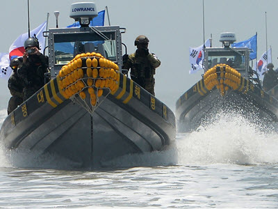
Banner image source: © Jung Yeon-Je/AFP via Getty Images. South Korean soldiers look at the sea as they patrol on the South-controlled island of Yeonpyeong near the disputed waters of the Yellow Sea at dawn on April 15, 2013. The island was shelled by North Korea in 2010.